There is some potential for a Pineapple Express among the charts from the Mauna Kia weather centre, with a tropical storm that may passes through Hawaii to Northern California. Either way there is a high likelihood of Ian and a side development (a "dual" keeping pace with Ian) absorbing anticyclonic air mass.

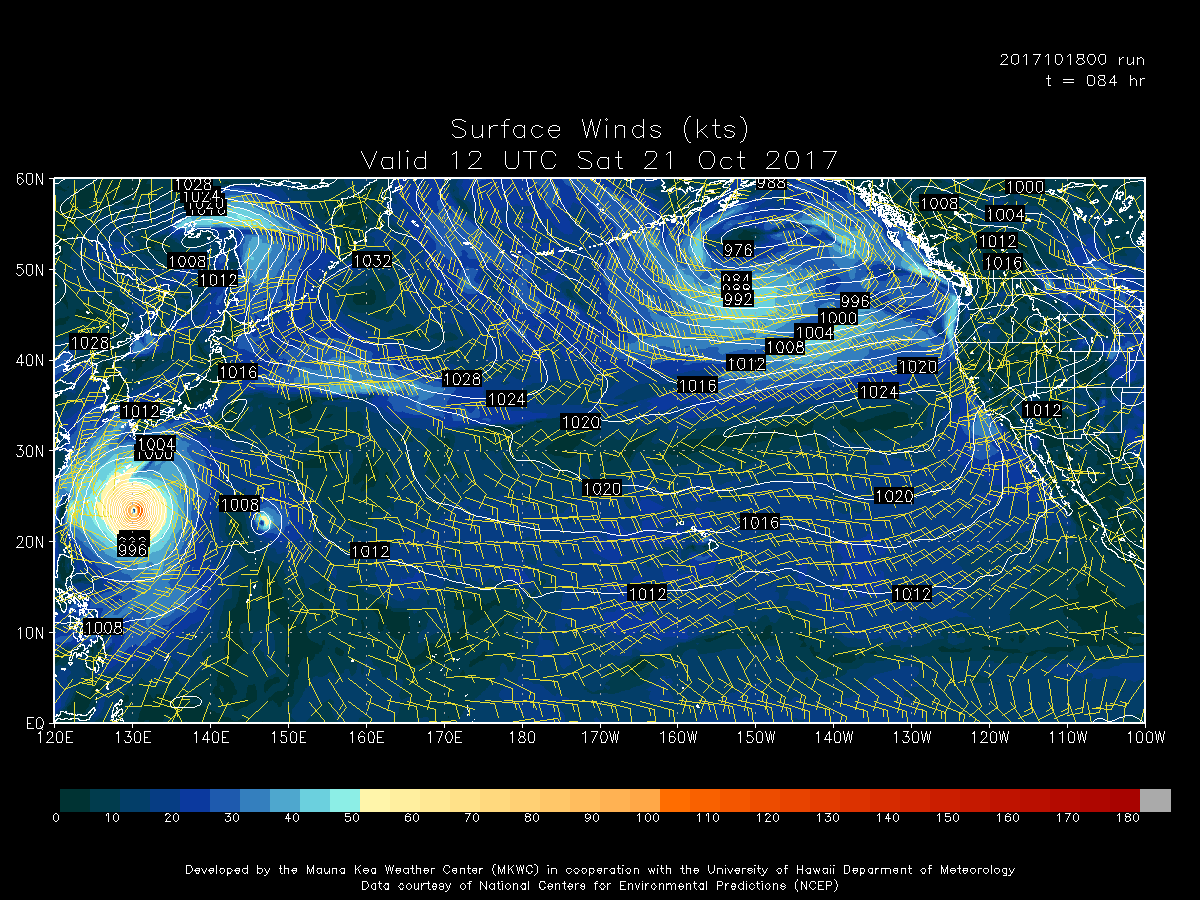
At the moment the charts show extra-tropical cyclones heading to the Gulf of Alaska but as the system develops if it takes on substantial anticyclonic air the course outlined may change substantially.

When the system is large enough to show an eye that is hollow (for want of the correct scientific term) it means that a large amount of anticyclonic air has been absorbed, in effect the system is a col. I don't know what the correct term for the development is. I doubt many of my avid fans had any idea of the phenomenon's existence.

Almost every one of the cyclones on the chart exhibit this behaviour. One such system would be enough to support an eruption. Hers are six such systems that reach the Gulf.

I am pretty sure that by the end of this run the sum total of watershed activity will have reached as far as Oroville. I hope there is enough lag in the system to secure the safety of the new concrete.

I think they are just about going to make it.

Notice that the major storms in the earlier charts had all been equally spaced with each sequence flowing to the Gulf of Alaska along the same route.

But with the last run the potential has changed.

At the moment the charts show extra-tropical cyclones heading to the Gulf of Alaska but as the system develops if it takes on substantial anticyclonic air the course outlined may change substantially.

When the system is large enough to show an eye that is hollow (for want of the correct scientific term) it means that a large amount of anticyclonic air has been absorbed, in effect the system is a col. I don't know what the correct term for the development is. I doubt many of my avid fans had any idea of the phenomenon's existence.
Almost every one of the cyclones on the chart exhibit this behaviour. One such system would be enough to support an eruption. Hers are six such systems that reach the Gulf.

I am pretty sure that by the end of this run the sum total of watershed activity will have reached as far as Oroville. I hope there is enough lag in the system to secure the safety of the new concrete.

I think they are just about going to make it.

Notice that the major storms in the earlier charts had all been equally spaced with each sequence flowing to the Gulf of Alaska along the same route.

But with the last run the potential has changed.
No comments:
Post a Comment