Well I am blowed! I finally got the images to load correctly on this website.

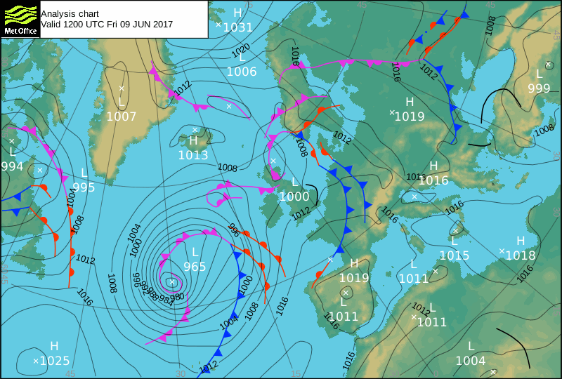
This is the normal course of events these days with the North Atlantic.

A large cyclon appears in the middle of the Mid Atlantic ridge and has a heart of warnm fronts coiled inside it.

It had appeared initially TAIAP from Newfoundland, just like its replacement.
It extends too far for the normal behaviour of a depression, It can not amintain a compressed or is that a decompressed core.

To fill a space that reaches from the same longitude as Iceland to that of the BAltic requires extensive decompression.
 |
| Where could all that lack of pressure come from? |
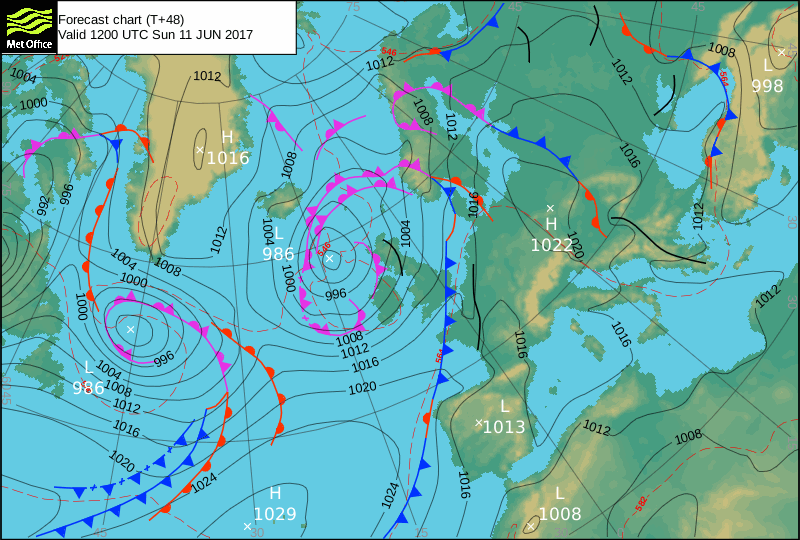
More importantly where did it all go?
It joined forces with the other Low and disappeared?
Elongation implies a mixed air mass is making it up. It has to separate out as the original anticyclone degasses. They are showing up as separated warm and cold fronts.
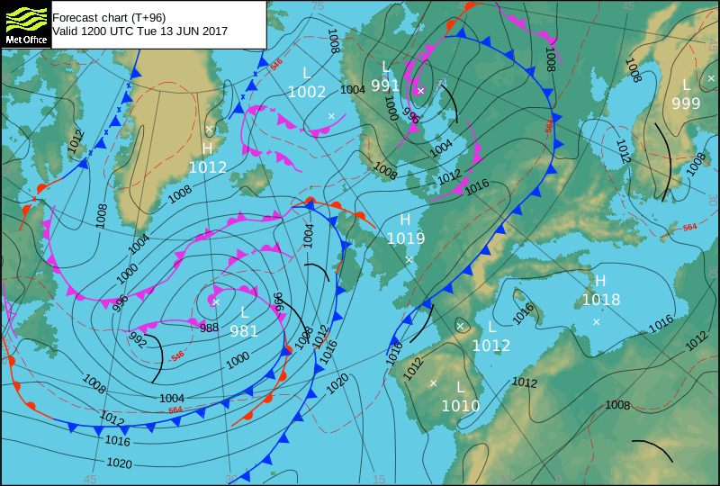
It is a volcanic signal but how did it generate?
Obviously there had been a tornadic spell enmeshed further back up the trail. So it is also a forecast of that.